The Humamantata property is located in Southern Peru and covers an area of 3,600 hectares. The property contains three different types of mineralization:
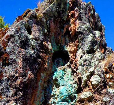
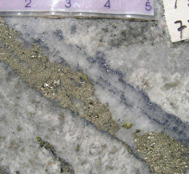
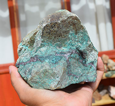
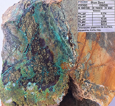
- Cu-Au Skarn/Porphyry type mineralization at the north and central areas of the property, where a porphyry of quartzmonzonite composition is in contact with limestones and sandstones of the Ferrobamba and Mara formations, respectively. The copper hypogene mineralization is composed by chalcopyrite, bornite, pyrite, and quartz stockwork associated to phyllic and potassic alteration. There is a significant development of supergene environment increasing the metal concentration near surface.
- Hydrothermal breccias/mantos with Pb-Ag, Zn anomalous in limestones and sandstones in the central side of the property, surrounding a Cu-Au Porphyry stock associated to a high magnetics anomalies.
- Extensive silicification/stockwork and advanced argillic alteration, in an environment typical of Epithermal type deposits, including Cu, Au, Ag anomalies. The mineralization/alteration hosted in sandstone layers of the Mara formations occurs in the southern and central area of the property.
The main structural and lithologic contact cross cut the property from south to north, generally covered by fluvial/colluvium sediments filling the creek. The Cu-Au Porphyry stocks outcrops in the north and central zones of this structural control.
Exploration Campaigns
From 2004 to present, two exploration campaigns were completed:
Cordillera de las Minas, 2004 - 2008
In 2004, Cordillera de Las Minas (CDLM) carried out a survey of the area, 49 rock chip samples were taken, four samples are taken from sectors 70563, 70564, 70565 and 7204, givingall high silver values between 26.6 to 87.8 gr / t; Au <0.18 gr/t; Cu with a maximum value of 0.18%; in addition to high values in Pb between 1 to 1.4% and Zn between 1.4 to 3.5%.
Panoro Minerals, 2014 - Present
The Company completed exploration in 2014 and 2015 including geologic mapping in 1:10,000 scale, covering an area of 2,000 hectares; a geochemical survey with the collection 326 surface rock chip samples; and Airborne K-Th spectral, Analitic Signal and Magnetic field, over an area of 3,600 has.
In 2018, Panoro and its partner, the Japanese Oil, Gas and Metals National Corporation (JOGMEC) agreed to a proposed exploration plan including an investment of US$3.0 million to be funded by JOGMEC under the terms of the agreement announced on October 2, 2018. The proposed work program included detailed mapping and geochemical sampling; geophysical surveys; and induced polarization; magnetics; gravity; self-potential and exploration drilling and continued until the summer of 2021. The Company and JOGMEC agreed to terminate the agreement due to delays and budget constraints in the planned exploration program, as a result of the COVID-19 Pandemic.
Luis Vela, P. Geo., Vice President of Exploration for Panoro and a "qualified person" under National Instrument 43-101, has reviewed and approved the scientific and technical information.


